A journey to the village of Kibithu and Kaho on the easternmost part of India is like a pilgrimage. Just around every corner of the perilous road, you will discover a new vista in all its sacred beauty.
Separated by the sinuous Lohit river, Kibithu and Kaho are adjacent villages nestled on a tri-junction with China on north and Myanmar to the east. It is a place where the sands of time stand still and a traveller can find peace and answers about self or others through the experience of the journey. However, just like reaching any other pilgrimage site, it is not an easy journey to Kibithu and Kaho but it is well worth the travel challenge.
Based on personal experience, this article will guide a traveller with useful insight to plan an immersive trip to Kibithu and Kaho. Consider it as a travel guide book to know what lies after each turn and twists of the road leading to this extreme eastern part of India.
Road to Kibithu and Kaho
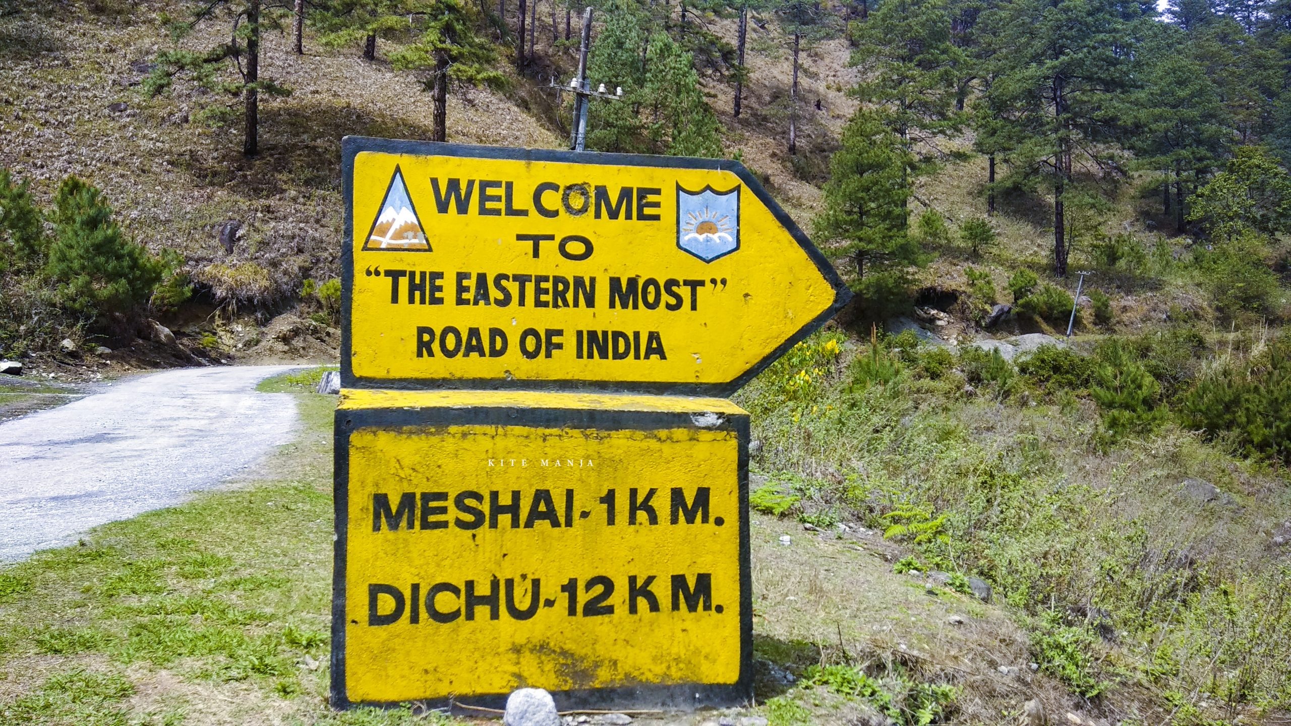
These two villages fall under the Anjaw district also known as the easternmost district of India. The distance from the nearest airport in Dibrugarh, Assam to the twin villages is about 400 km and takes two full days to reach. The only available route right now is Dibrugarh > Tinsukia > Namsai > Tezu > Hayuliang/Hawai > Walong > Kibithu and Kaho.
The nearest railhead is Tinsukia railway station and from here the onward journey can be resumed in a private taxi. There are no direct buses or shared taxis available but a break journey can be done from Dibrugarh/Tinsukia to Tezu and from Tezu to Walong. It is advised to book a private taxi for a hassle-free tour of Kibithu and Kaho.
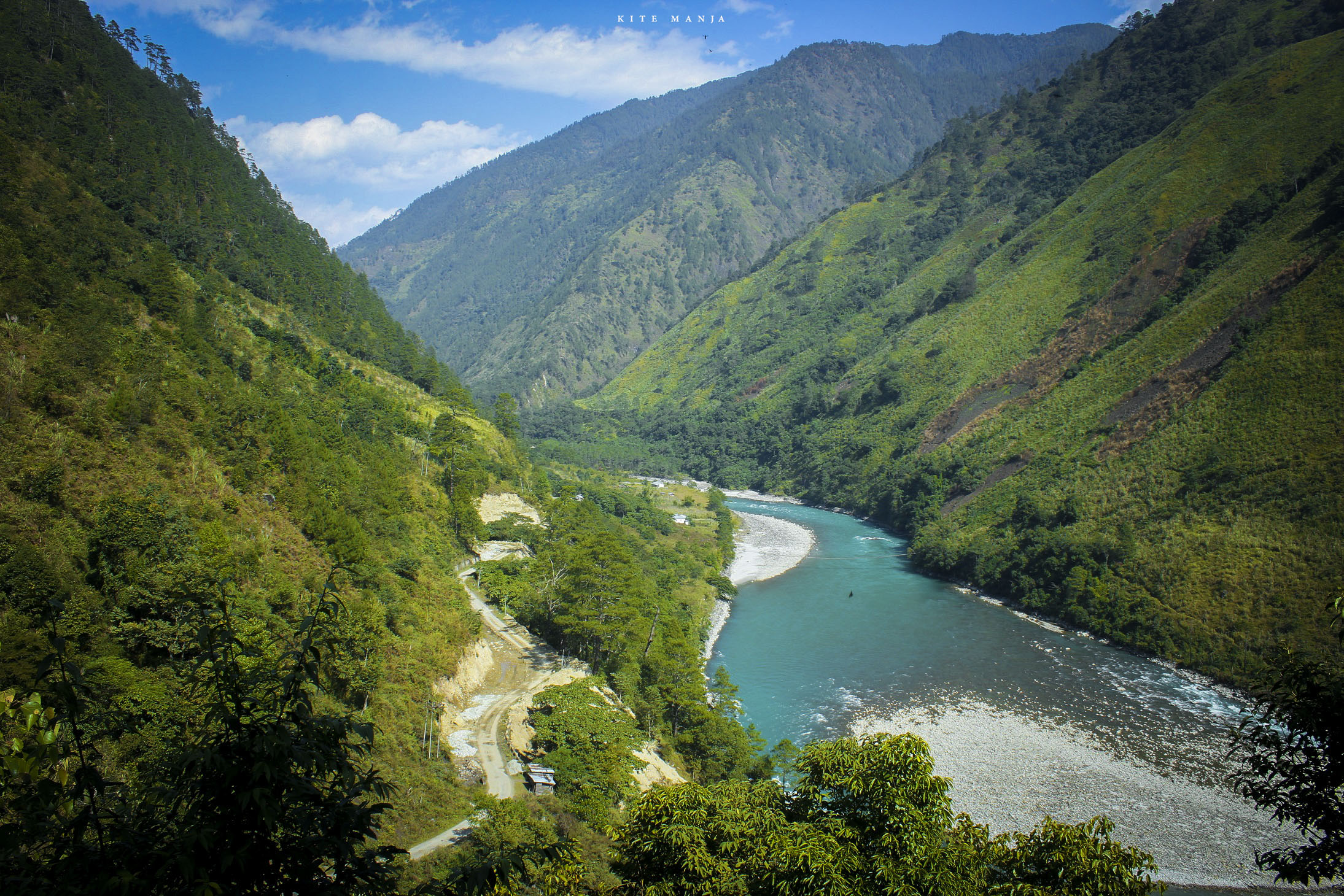
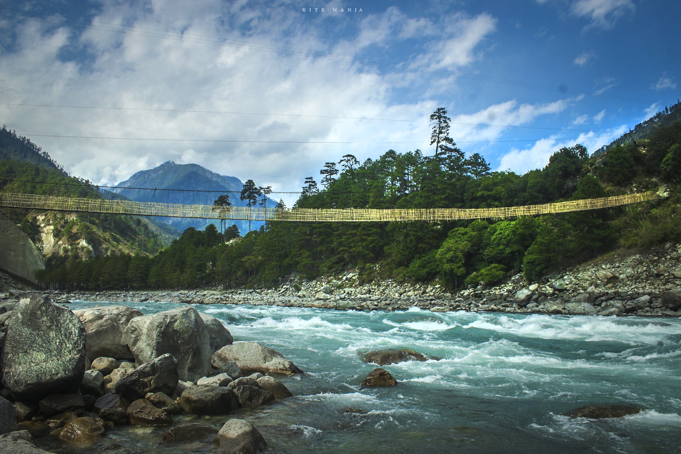
Till Tezu is a two-lane highway and thereafter it’s a single lane uphill drive with bare minimum traffic on the road. The road is harsh and bumpy at times but the alluring views from the high mountain viewpoints cease the fatigue. The serpentine road is dotted with waterfalls runs parallel to the Lohit river. The sound of the gushing white waters while crossing the truss bridges fill the heart with an exhilarating emotion and the sight of the hanging bridges connecting distant hamlets brings a sense of contentment.
En route, tiny villages of a kind and hardworking Miju Mishmi tribe can be seen on the lower slope of the mountains. These tribesmen follow an agrarian lifestyle and primarily cultivate Cardamom which turns the mountain tops into an artwork filled with shades of green and yellow.
Hawa Camp View Point, Chingminti bridge, Samdul bridge, Mompani Waterfall are some amazing locations for a quick pit stop on the way to Kaho and Kibithu.
Destinations for Stopover
From Dibrugarh, it is difficult to reach Kibithu in a single day and it is not advisable to drive or ride at night. If a traveller leaves from Dibrugarh or Tinsukia in the early morning, then he/she can stop at Hayuliang or Hawai for a night but if they leave at noon then the best stopover is at Tezu.
There are no homestay or hotel in Kibithu and Kaho so Walong is the closest town to stay and explore the nearby areas.
Tezu
Tezu is a headquarter of Lohit district and the fourth largest town of Arunachal Pradesh. There is an eco-camp, hotels, lodges and restaurants available in the town. Distance from Tezu to Walong is 200 km and it may take 10 to 12 hours to reach. Guesthouses in Hayuliang and Hawai are government-owned so it is not certain that a room will be available on the desired dates. Thus it is advised to drive straight to Walong from Tezu as it saves one full day.
Hayuliang
100 km from Tezu, Hayuliang is a small settlement with a peaceful vibe to it. The place enjoys a pleasant and salubrious climate and according to the Mishmi dialect, ‘Hayuliang” means ‘the place of my liquor’. There is a government guesthouse and a small hotel in the town. Prior permission is required to stay at the guesthouse and chances are less if there are any government officials on tour for work. There is also a new Inspection Bungalow in a place called Hulang Basti about three km before reaching Hayuliang town.
A couple of rice hotels and an ATM is available in the main market area. Near to Hayuliang is Khupa (very close to Hulang Basti) which has the only petrol pump in the region. Keep in mind that there is no fuel station or ATM anywhere on the highway after crossing Hayuliang. Distance between Hayuliang and Walong is just 100 km and takes about four to five hours or more depending upon the road condition.
Or
Hawai
is the headquarter of Anjaw district and has better accommodation facilities compared to Hayuliang. It falls 58 km south-east of Hayuliang by road towards Walong. There are two guest houses available in Hawai and offer good food. Town also has an ATM to refill your pocket.
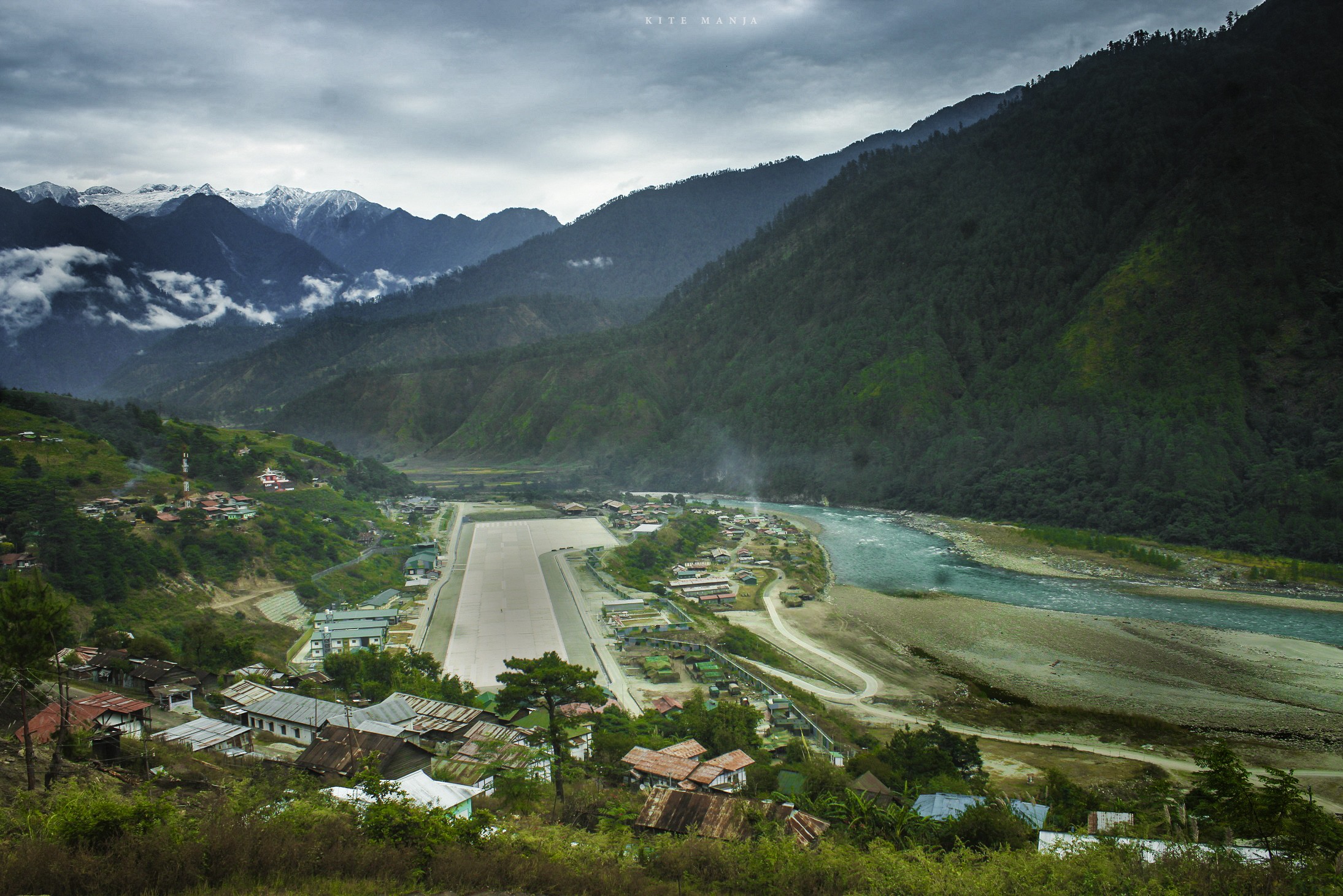
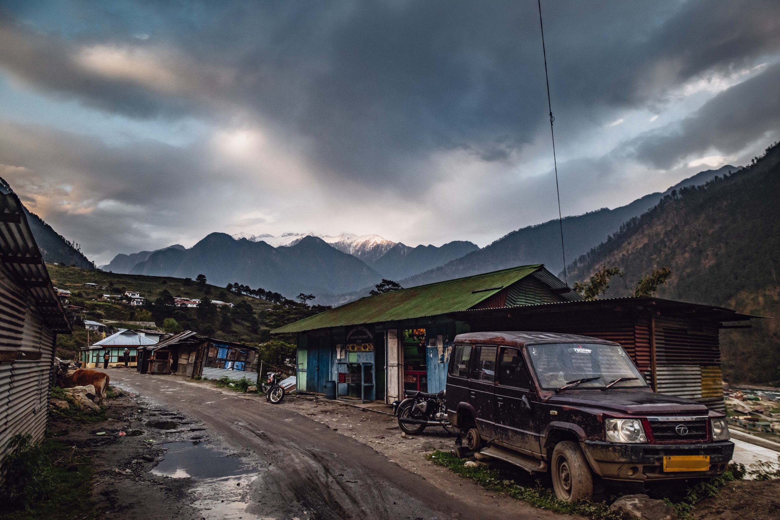
Walong
Walong is the easternmost town of India. This picturesque cantonment town is historically important because of the gallant fight between the Indian soldiers and invading Chinese forces in 1962. The Print states that in Walong, the Indian army fought its only counter-attack and was able to hold back the enemy for a few days.
As per the Mishmi dialect, this easternmost town of India means “a place full of bamboos”. It has a government guesthouse and a new tourist lodge in Tilam village on the bank of the Lohit river. Tilam is on the way to Kibithu and Kaho. There are no accommodation options available in Kaho or Kibithu so Walong or Tilam can be a perfect base to visit the twin village and the nearby attractions.
Just below the guesthouse on the main road, there are few shops to buy snacks and beverages. They also sell momos, maggie, thukpa, beer and a few shops even sell petrol and diesel in black.
Things to do in Kibithu and Kaho
Kaho & Kibithu are small villages with a handful of families at an altitude of 1305 Mt. above sea level. These two villages are so close to McMahon Line that it is hard to presume which hill belongs to India and which to China. The best part of visiting Kibithu and Kaho is the journey and the captivating views of the pristine mountains. Apart from it a traveller can also,
✔️ Visit a local family in the area and understand their culture and tradition.
✔️ Strike a conversation with the village elders and know about the stories of the 1962 Sino-India war.
✔️ Have a cup of tea and hot Maggie at a small food stall in Kibithu.
✔️ Try walking in the hanging bridge before reaching Kaho.
✔️ Walkthrough the farms and gardens with the owner of the house.
✔️ Visit the Gompa (a Buddhist Monastery) in Kaho overseeing the beautiful Lohit river and the ridges on the Chinese territory.
✔️ Try to sight different bird species found exclusively in the region.
✔️ Count numerous Indian army bunkers which testifies the bravery and sacrifice of the Indian army during the 1962 India-China war.
✔️ Take photographs and make memories of a lifetime.
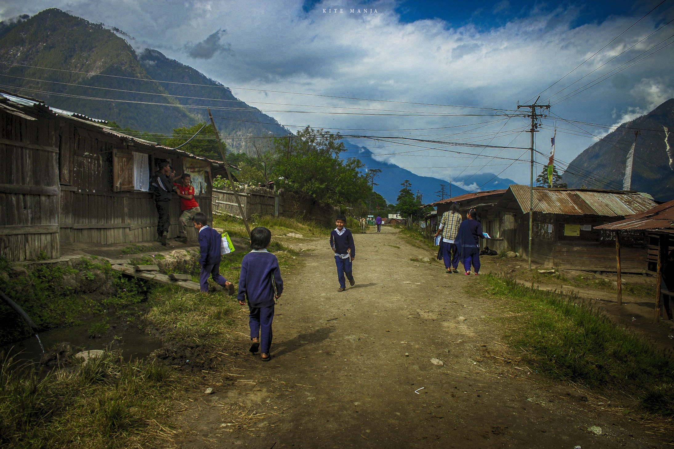
The Ethnicity of the locals
Kibithu, Kaho and 13 other nearby villages are home to one of the least known tribes of the world, the Meyors. The Meyors have migrated from the north of Tibet and follow Mahayana sect of Buddhism. As per the 2002 census, the total population of Meyor stood at 300 and anthropologist Mridul Kumar Chakravorty further states that even now the total number including infants is below 1000. They are hard-working cultivators and co-exist with their Mishmi neighbours peacefully.
Nearby Places to Visit
Hot Water Spring
Heated and brought up to earth’s surface by the geothermal forces, there is a set of two hot water springs close to each other at Tilam village on the bank of Lohit river. According to the local belief, one is a male and the other one is female. During rainy season male spring becomes warmer than the female and the vice-versa on other seasons. The hot springs are just meters away from the tourist guesthouse in Tilam.
Helmet Top
18 km by the road above Walong, it is a hilltop that was once a vantage point for the Indian soldiers. At present, there is memorabilia on top that stands tall in the memory of the martyrs who sacrificed their lives in the 1962 war. There are unidentified helmets and used bullet and mortar cartridges but at the moment the Indian army has restricted the civilian visit to the top.
Dong
Situated on the confluence of rivers Lohit and Sati, Dong valley is surrounded by snow-capped mountains and pine forests. Once Dong used to be the home for a handful of Meyor families but due to hardship of fetching water to their hillock hamlet, they abandoned the place and shifted to the lower edge of the valley. Now it’s a destination for nature lovers and adventure enthusiasts to witness the first sunrise in the country. To embrace the first ray of sun in India a traveller will have to start at about 3.00 am from Walong to the last motorable point. For an average walker, the trek to Dong to embrace the sunrise will take almost 90 minutes one-way.
Dapti Falls
It is a two-tiered cascading waterfall set against the backdrop of majestic blue hills. On a clear day, the grandeur of this waterfall will leave a traveller awestruck. Dapti Fall is not accessible by road and can only be admired from a distance. The unnamed viewpoint is close to Namti Plains.
Namti Plains
Namti Plains is a hallowed ground which is an anecdote of a historic battle against the Chinese invaders from October end to mid-November of 1962. China recalls this defensive position as the “Tiger’s mouth” because the Indian forces stopped the Chinese advance to Walong despite being vastly outnumbered and outgunned.
In order to progress the war, the Chinese army had to climb the highest ridge in the area where again ferocious battles were fought. Unfortunately having been outnumbered, the defenses around Namti Plain fell on 16 November 1962 but not before the Indian army had given a bloody nose to the enemy for 22 days.
There is a war memorial on the Namti Plains overlooking the Lohit River where most of the crossfire had taken place during the war.
Trivia about Kibithu and Kaho
Some of the lesser-known facts about Kibithu and Kaho are,
✔️ Kaho is the last border village near the actual line of control which can also be termed as the first village in India.
✔️ There are only 12 families living in Kaho.
✔️ In traditional Meyor houses, not a single nail or a screw is used for construction.
✔️ A proposed 2000 km Arunachal Pradesh Frontier Highway will pass through Kaho and Kibithu.
✔️ Lohit River which originates in Tibet region enters India from Kibithu.
✔️ Kibithu is the second BPM (Border Personal Meeting) Point in Arunachal Pradesh after Bumla in Tawang. At BPM points, the representative of Indian and Chinese armies meets to resolve any disputes.
✔️ Before the 1962 war, locals from Kibithu used to supply rice and other rations to a cooperative in present-day Zayü town (Rima) which falls under the Tibet Autonomous Region under the Chinese occupation.
✔️ The area near Kibithu and Kaho is home to some of the rarest and exotic birds and mammals.
These two quaint far-eastern villages of India will never disappoint a traveller. Write to us at info@kitemanja.com to let us plan your journey to Kibithu and Kaho.
